After crossing into Ohio at Moundsville, WV, I took Rte 7 south along the Ohio River. It was quite foggy along the river.
At Clarington, I snapped a picture of this mural depicting a riverboat before heading west.Today's tour begins in the quiet little town of Woodsfield,
where, being from Florida, I was surprised to find the home of the Seminoles!
We will be following Rte 26, south through the Wayne National Forest, a pastoral corner of southeastern Ohio.
Some of the nation's oldest oil wells are along this route. Hmmm...is that a human skull at the base of the oil well?
Almost every farmer's field had one, but none of them seemed to be operating any more.
Also along the way we'll pass many picturesque weathered barns, some with advertising.
Part of Rte 26 snakes along with the Little Muskingum River past small hayfields,and alternately climbs to tree-covered highlands.
I wonder if the farmers got paid for such advertising.
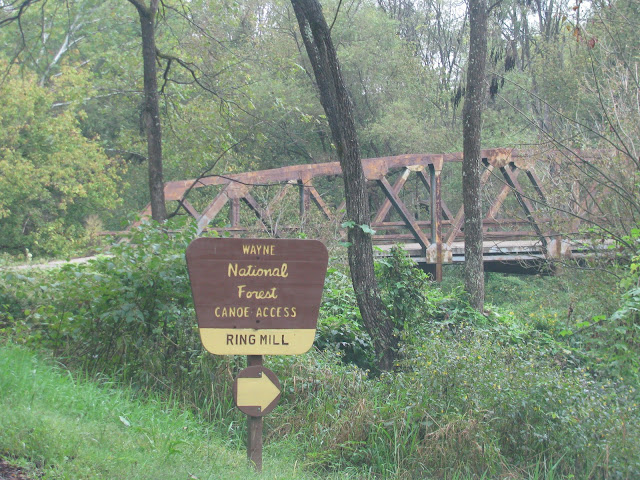
There are four no-fee National Forest campgrounds along this route. The first one we come to is down a gravel road.
Around this barn,
And over this old bridge.
There is a picnic area,
lots of yellow daisies in bloom,
a quiet stream with canoe/kayak access,
and three well-maintained, free campsites. We were aiming for one of the campgrounds farther south, so didn't stay here.
There is also this historic house to read about.
Of course what this Rte is really known for is its covered bridges.
At 192 ft., Knowlton Covered Bridge is one of the two longest in the state.
On down the road,Uphill and downhill,
winding through several small towns,To the next covered bridge at Rinard Mills. Originally built in 1871, this bridge has been washed away by floods 3 times, and each time it was rebuilt. There is another NF campground along the river near here, but we didn't drive down to it.
More old barns,
Sometimes just caught in the rearview mirror.
This is Hune Covered Bridge, built in 1879. The campground here is where I planned to stay as the North Country National Scenic Trail goes through here, but I changed my mind when I realized I had to drive through the bridge to get to it.
I was sort of like the old farmer that came upon the bridge with his load and saw that the entrance seemed large enough, but considered the hole at the other end entirely too small!
So on over the hills I go to the last campground,
Lane Farm Campground has 4 free sites along the river, but no hiking trail.3 of the sites were already taken, so I was fortunate to get this one...a nice paved and level site. I really like the National Forest campgrounds.
This campground was near the end of our tour in Marietta, probably what made it a popular campground for homeless, long-term campers. My neighbor was an unfortunate man who was living with his little dog in his car temporarily while waiting for his disability claim to go into effect. (A six-month wait, and he still had 3 to go.) He had grown up in Marietta and had a lot of information about the area. I left him a big pot of soup I had made too much of. I wonder what he'll do when the weather turns really cold.
In the morning I skipped the last covered bridge which was on a side road, and the Museum of the Northwest Territory I had planned to visit. Marietta was the site of the first permanent settlement in the NW Territory.


No comments:
Post a Comment